We remain fully operational. Our teams are working around the clock to ensure your deliveries continue safely.

DOWNLOAD THE APP


Customer Services
Copyright © 2025 Desertcart Holdings Limited
DOWNLOAD THE APP


🧭 Unlock Shenandoah’s secrets with the ultimate trail companion!
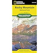
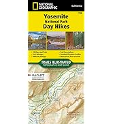
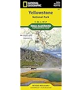
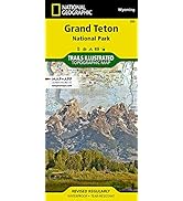
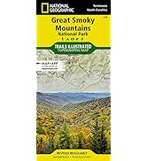
The Shenandoah National Park Map by National Geographic is a premium, waterproof, and tear-resistant map designed for serious hikers and outdoor enthusiasts. Featuring a full UTM grid for GPS navigation, detailed mileage between key points, and comprehensive coverage of trails, waterfalls, and wilderness areas, this map is your essential tool for confident exploration and trip planning in Shenandoah and surrounding regions.


| Best Sellers Rank | #69,636 in Books ( See Top 100 in Books ) #38 in South Atlantic United States Travel Books #86 in United States Atlases & Maps (Books) #103 in Hiking & Camping Excursion Guides (Books) |
| Customer Reviews | 4.8 out of 5 stars 396 Reviews |
M**K
I love this map series
I love this map series. They are my go-to maps for backpacking. They show campsites and shelters, which you usually have to scour the internet for. It shows trails and the distances--as well as the quality of the trail to some degree; for example, a black trail is well-maintained. A grey trail is THERE, technically, but isn't maintained by the park and might be obscure. I do wish the maps marked clear water sources (with, of course, the caveat that packers should always call the park to check on said source). Parking is clearly marked and if the portion of the part costs money to enter. It shows rock climbing areas. It shoes fishing areas.These are also waterproof. I'm glad I keep it with me when I hike; I've run into a few hikers here and there who are turned around and I can show them where they are and where to go. The map is so clear that, literally, in about 30 seconds, the hiker knows what direction to go and some marks to look for (like a lean-to or lake). I also use this map to start researching a trip. I just put out the map and look at the distances and presence of water or whatever. If you see an area, for example, with A LOT of parking, that area is probably more congested than you want. I'd recommend this map to anyone of any hiking level.
W**S
Great detail and also nice material
This map is terrific. It has quite detailed information about Shenandoah, and also parts of George Washington National Forest and the surrounding areas. I was able to easily find the trails we've already hiked, and also scope out other trails for the future. The paper is also a very pleasant, smooth material that is apparently waterproof. (We still have to test that.)
B**R
Great maps with trails well marked
Great maps with trails well marked. Very handy for hiking! Only issue I had was that I ordered 3 of these as a gift. One came fully sealed in plastic, another had the plastic ripped and falling off, the 3rd had no plastic at all. However, maps were in good condition with no damage. Just would have preferred not giving a gift that looked as though it might have been used.
L**B
Great map
This map was a must-have item for our trip to Shenandoah. It was very detailed, which is super important when you’re hiking through the wilderness. I liked that it was waterproof and durable too.
S**K
Beautiful clear map, waterproof, 1:75k scale
Nice looking map, trails and features clearly marked. I wish it were more zoomed in, for hiking/contours, like the old USGS 24k quad sheets. This map is 1:75k, though has some 1:30k insets. Good for overview, but maybe not the details. I’d buy it again.
M**N
Must-have for a visit to Shenandoah
Cell service is limited in Shenandoah, I used this map a ton during my visit. I recommend also getting a trail map, it was helpful to look at both side-by-side.
U**R
Great map
Much sturdier and more detailed than the ones at the visitor center. Contour lines are very helpful in planning hikes. Only challenge with Shenandoah is that the park is so big that the scale is not as close up as one might like. Zooming in further would result in an unwieldy map unless it only covered the park and not the surrounding area.
K**Y
Great and detailed map
This little map shows much more than I expected. All types of different trails are highlighted in different colors. Hiking trails, Horse trails, bike trails, etc... all shown very clearly. Shelters, campgrounds, stocked trout streams, etc...waterfalls, swimming...and so much more. Great. I cannot wait to go.
Trustpilot
4 days ago
2 months ago