EXP OL17 Snowdon
Product ID: 441224449
Desertcart purchases this item on your behalf and handles shipping, customs, and support to Kyrgyzstan.
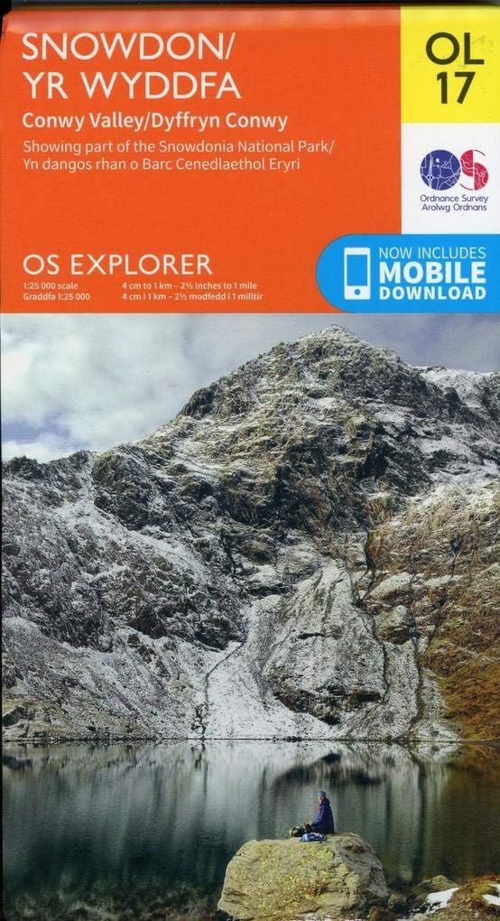
Map sheet number OL17 in the OS Explorer map series is the ideal map for exploring the mountain scenery in Snowdon. This is the most detailed mapping in 1:25k scale, showing footpaths, bridleways and terrain information. This area, famous for its fantastic walking routes, is home to the highest mountain in Wales. Take one of the six well mapped routes to the summit of Mount Snowdon and enjoy the views! Snowdon (Yr Wyddfa), Llanberis Path, Conwy, The Menai Strait and Colwyn Bay, Llandudno, Beddgelert, Conwy, Bethesda, Betws-y-Coed, Bangor and Caernarfon. Also includes other popular landscape features in the Snowdonia range such as Carnedd Llewelyn, Carnedd Dayfydd, Glyder Fawr, Glyder Fach, Tal y Fan and Tryfan. Review: The heart of Snowdonia... - This Ordnance Survey Explorer map captures the heart of the Snowdonia National Park in northwest Wales. Coverage includes Snowdon itself, the valleys entering the park from the area of the Menai Strait, and the area west of the Conwy River. The map is a very user friendly 1:25,000 scale, with easy to read color graphics and a download for your mobile phone. Although the cover is plasticized, the map itself is paper and will need protection from the weather. The Snowdonia National Park contain tremendous landscapes and opportunities for hiking and climbing, but there is also potential danger due to rough ground and variable weather conditions. Highly recommended to the enterprising traveler. Review: Trustworthy - Good map
| Best Sellers Rank | #3,095,719 in Books ( See Top 100 in Books ) #1,454 in Walking (Books) |
| Customer Reviews | 4.8 out of 5 stars 1,379 Reviews |
H**E
The heart of Snowdonia...
This Ordnance Survey Explorer map captures the heart of the Snowdonia National Park in northwest Wales. Coverage includes Snowdon itself, the valleys entering the park from the area of the Menai Strait, and the area west of the Conwy River. The map is a very user friendly 1:25,000 scale, with easy to read color graphics and a download for your mobile phone. Although the cover is plasticized, the map itself is paper and will need protection from the weather. The Snowdonia National Park contain tremendous landscapes and opportunities for hiking and climbing, but there is also potential danger due to rough ground and variable weather conditions. Highly recommended to the enterprising traveler.
C**S
Trustworthy
Good map
V**E
schneller geliefert als gedacht !! super
zum einen schneller geliefert als gedacht !! super und die qualität der OS mappen kenne ich schon, sind ungeschlagen gut.
P**N
My home is on this great map
Beautiful north Wales. My home in the Conwy Valley is on this map. We're so lucky to have such good mapping in the UK.
S**K
Quality map
Very detailed map
C**L
Useful Map
Great for planning trip to snowdonia, looking forward to using it in the summer. OS maps are the best for those finer details, footpaths, bridle path etc
Trustpilot
2 weeks ago
2 weeks ago